72x39m Topography AutoCAD DWG Site Land Plan Contours Layout Details
Tags
#topographic plan#DWG#site layout drawing#AutoCAD topography#72x39m topographic site plan DWG#AutoCAD topographic layout drawing
Ratings & Reviews
⭐
No Reviews Yet
Be the first to share your experience with this product. Your review helps others make better decisions!
★★★★★
Description
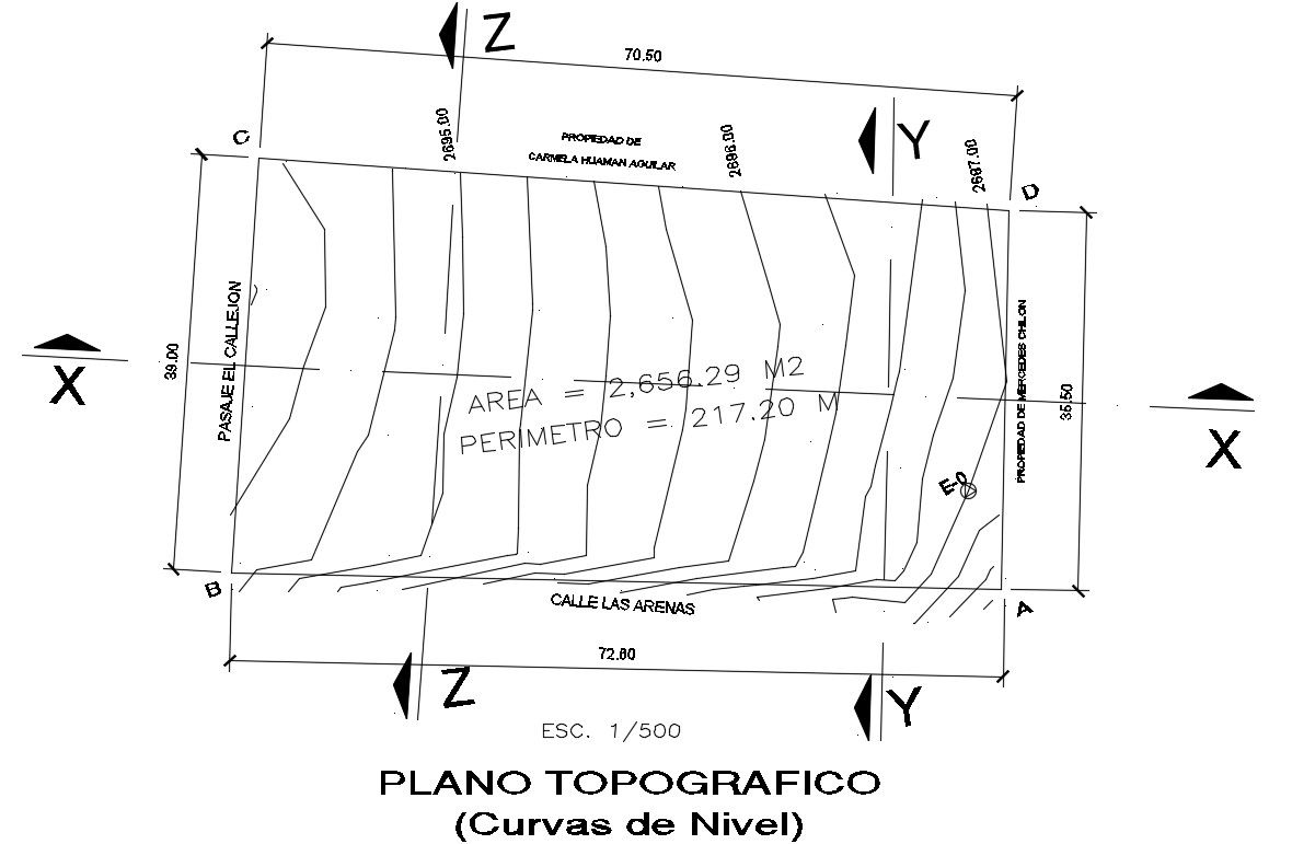
This DWG file provides a comprehensive 72x39m topographic site layout, featuring contour lines, elevation data, and site boundaries. It's tailored for AutoCAD users involved in site planning, land development, and infrastructure projects. Suitable for government proposals and urban planning, this drawing aids in accurate land analysis and design. Utilize it for efficient site layout and development planning.
Uploaded by:
Pavithra
Tags
#topographic plan#DWG#site layout drawing#AutoCAD topography#72x39m topographic site plan DWG#AutoCAD topographic layout drawing
Ratings & Reviews
⭐
No Reviews Yet
Be the first to share your experience with this product. Your review helps others make better decisions!
★★★★★